Project 04 / Conservation technology
Te Ranga Wairua
Turning Field Data into Conservation Insight
Te Ranga Wairua is a private conservation mapping and reporting portal.
Turning Field Data into Conservation Insight
Te Ranga Wairua is a private conservation mapping and reporting portal.
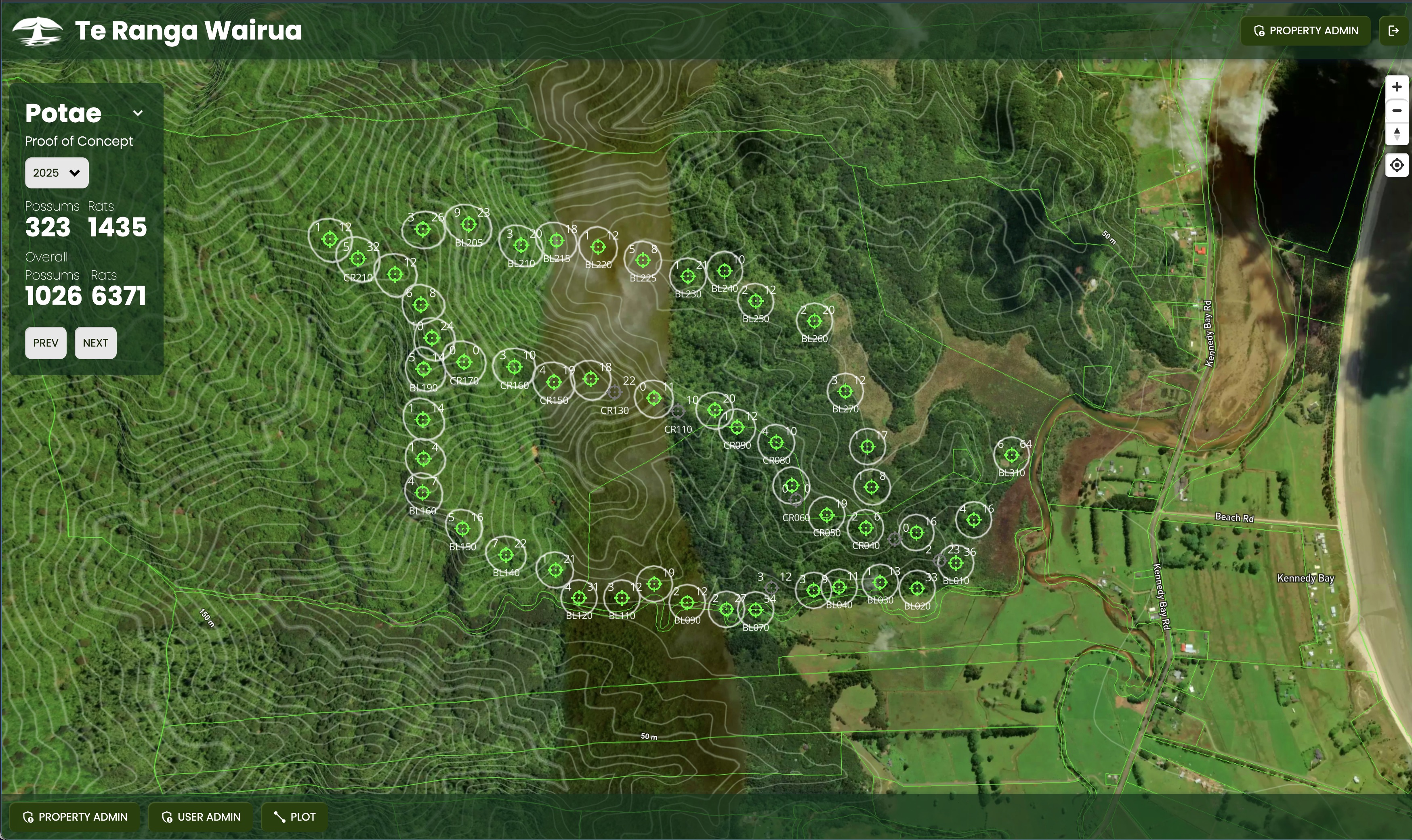
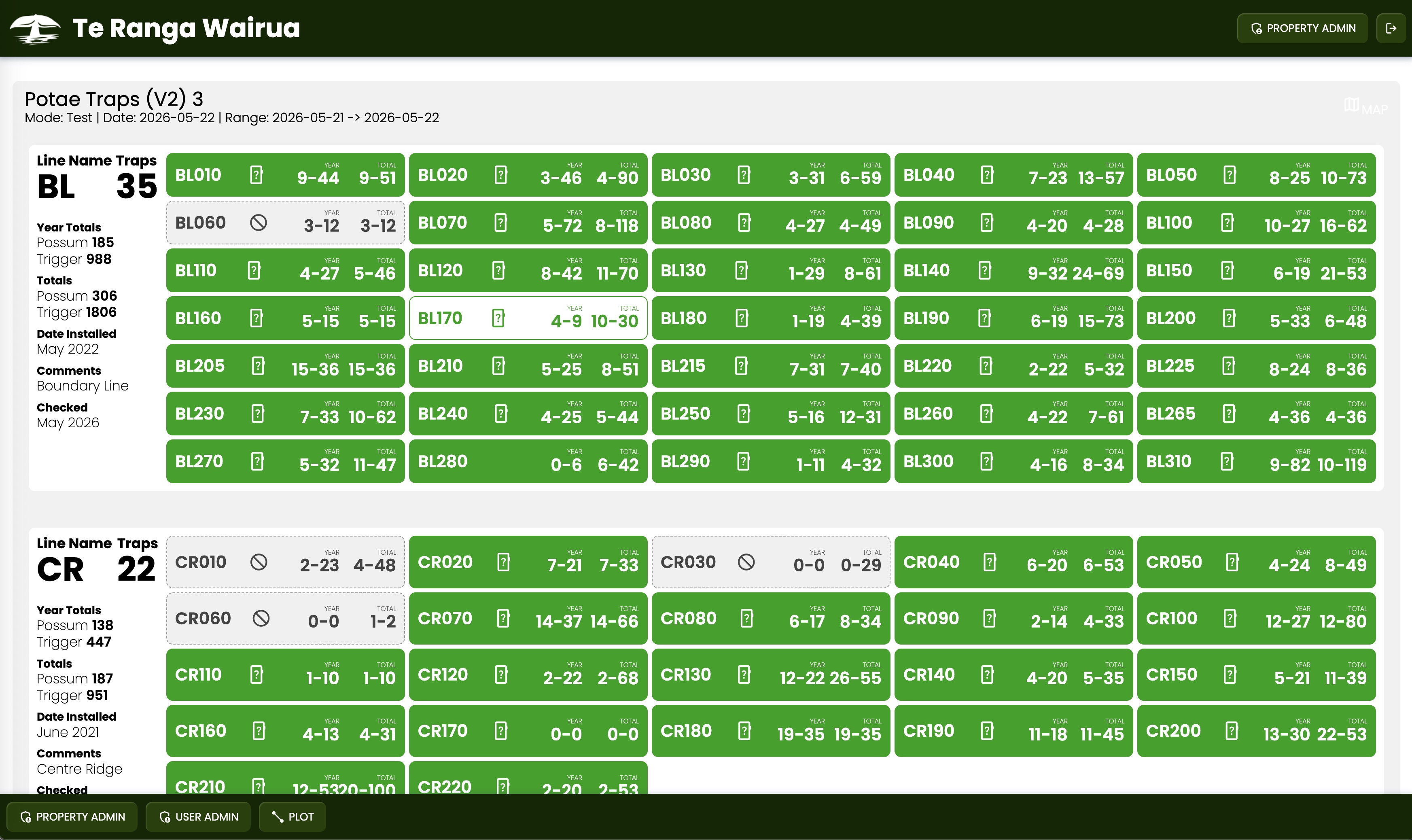
It was built to help display trap and tracking data across multiple properties within the trust's network. Each property has its own portal, showing trap locations, reporting data, catch history and up-to-date results for rats, possums and other field activity.
The goal is simple: make conservation data easier to see, easier to understand and easier to act on.
Why It Exists
The original problem was visibility.
The traps were collecting data, and there was an app showing some of that data, but it was not doing enough with it. The trust needed a way to see the whole network properly: where the traps were, what each property was doing, how many kills had been recorded and what was happening across the wider conservation project.
To solve that, trap data was brought into a custom system, converted into a database and displayed on a map.
Since then, the trap manufacturer's own ecosystem has changed, and the system now connects through an API.
But the reason for building Te Ranga Wairua has stayed the same.
The data needed to become useful.
Not just stored.
Visible, understandable and available to the people managing the work.
The Conservation Goal
The wider project supports conservation work around a threatened wetland connected to Māori land and home to rare native birdlife, including the Australasian bittern.
Like a lot of conservation work in Aotearoa, predator control is a major part of the job. Rats, possums and stoats all put pressure on native birds, trees and the wider ecosystem.
The long-term aim is to support a trap network that helps protect the northern tip of the Coromandel, creating a stronger pest-control corridor from coast to coast.
Te Ranga Wairua supports that work by making field data easier to see, report and act on.
What It Does
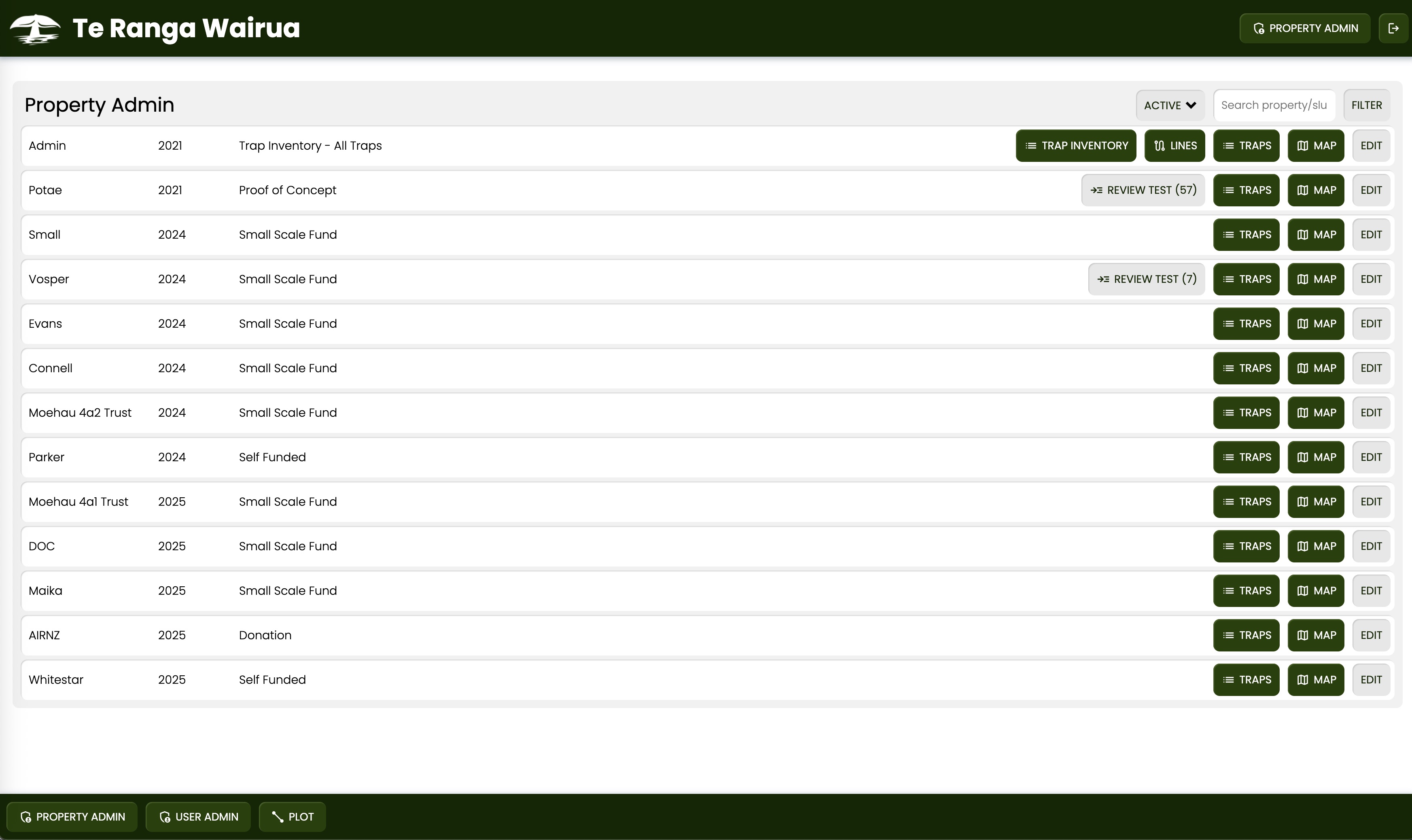
Te Ranga Wairua gives properties in the trust's network private access to their own conservation data.
The system displays trap locations, reporting activity, kill counts and up-to-date field information on a visual map. It is designed to be clear enough for regular users, not just people with technical or GIS experience.
The map matters.
It could have been built as a purely utilitarian tool, but conservation work is spatial. Seeing where traps are, where activity is happening and how properties connect makes the data more useful.
The system turns field activity into something people can actually read.
Why the Data Matters
This project is also about control.
The trust is small, and the work is local. The data should stay with the people doing the work, managing the land and protecting the wetland.
Te Ranga Wairua is intentionally private. Landowners, property managers, trappers and trust members use it within a locked-off ecosystem.
That is important because conservation data is not just numbers on a dashboard.
It represents field work, land relationships, predator control, funding needs and long-term ecological goals.
Owning and understanding that data matters.
Where It Is Now
Te Ranga Wairua is actively used and remains central to part of the trust's conservation work.
Like the wider project, the system keeps evolving. There have been hiccups along the way, especially around access to data and changes in the trap manufacturer's ecosystem, but the portal still plays an important role in bringing the trust's field data together.
It is not a finished product in the traditional sense.
It is a working system that continues to change with the needs of the project.
The Point
Te Ranga Wairua exists because conservation work needs practical systems, not just collected data.
The traps, reports and field activity already produce information. The value comes from making that information visible, understandable and useful to the people doing the work.
This project turns trap data into a private mapping and reporting system that supports real conservation decisions.
It is practical software for real-world field work.